The right mix
- Andreas
- Jan 9, 2019
- 6 min read

Updated: Apr 27, 2020
Long gone are the days, where a navigator was tasked to determine the aircraft position using multiple sources and then bring the steering command to the pilots. Today, most aircraft have “happy boxes” that we call Flight Management System (FMS), performing the art of navigation. Transport category aircraft have a variety of inputs to these boxes, typically some inertial references, some GNSS and some ground-based sources. Generally, pilots are given the option to deselect individual sources or to view individual performance, such as “IRS position", "GPS position" etc.. The FMS position is usually derived using a mix of the available sources, depending on several criteria. So one might ask: “What mix provides the best navigation solution?”
The answer is certainly: “It depends…”

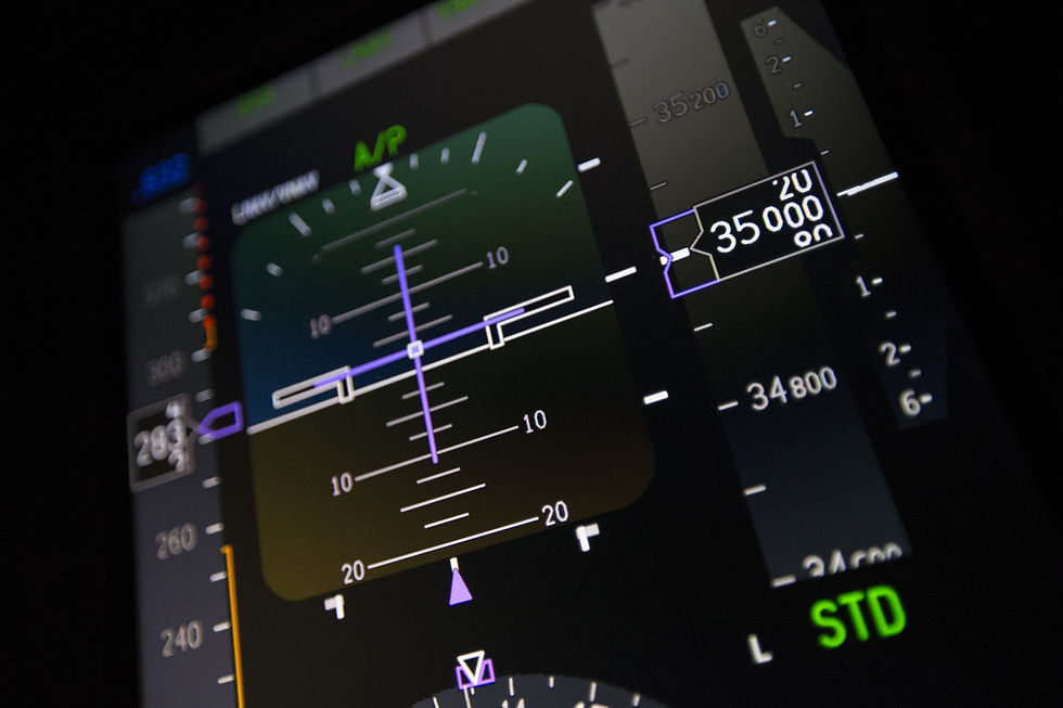
Figure 1: "Happy box" (Flight Management System Crew Interface)
One of my professors back at university once stated at the beginning of a navigation system lecture: “There are only two techniques of navigation: “Dead Reckoning” (DR) and “fixing”. Every navigation system, no matter how old or new, can be classified as one or the other. DR in this context includes any kind of integration process.
I was fascinated by that simple statement and in that instant thought about every navigation method I knew…
He was right, whether it is pure “pilotage” (looking out and thereby taking bearings and distances), using a stopwatch and some speed information, celestial navigation, DECCA, OMEGA, LORAN, DME, any GNSS or a high-grade IRS, they all fit into one of these two categories. Ever since then, when I am introduced to any kind of navigation system, I carry out this “classification” immediately.
The technique of DR is very old and was amongst many others, used successfully during the 15th century by Christopher Columbus. He recorded the progress of the voyage using a “Traverse Board”, a device that kept track of speed and heading for several hours [1].
Fixing, on the other hand would involve celestial navigation or bearings from the coastline, to stay in that era. Today, a typical DR system is the IRS and a typical fixing system would be a GNSS.
As it turns out, these two techniques complement each other in a beautiful way: All DR systems need some kind of “starting point” and usually their errors increase over time, but over small time frames they tend to be very accurate. On the other hand, fixing systems have good long-term characteristics, but can be very “jittery” in the short term [2] [8].

Figure 2: Behaviour of GNSS and IRS mean position error over time (static position)
The Figure above makes it obvious, why DR and fixing complement each other very nicely and together deliver the best performance. The critical question is of course: How to mix the two?
Avionics manufacturers are usually very quiet about how exactly they mix navigation sensor data, for obvious reasons. Today, civil aviation relies heavily on the US GPS and inertial systems [5]. Depending on the level of integration, the industry distinguishes between “loosely coupled” and “tightly coupled” systems [4]. Most architectures involve some form of Kalman filter, an ingenious way of merging GNSS and IRS sensor data. The loosely-coupled system only uses position outputs from both sources to feed the Kalman filter, whereas the tightly-coupled version also incorporates GNSS pseudo-range and Doppler measurements in the filtering process [4].
The derivation of the Kalman filter is quite mathematically intense and of no use from an operational perspective, however understanding the general concept can be quite helpful:
In simple terms, the Kalman filter uses a kinematic model of the system to predict its future state (i.e. position, angular rates etc.) It then adds the navigation sensor data to correct the state estimation [2] [3] [4]. Ingenious: It does not only predict the future system state, but also the uncertainties (errors) associated with that prediction and the measurements [4] [8]. The key advantage: Depending on the quality of the sensor data, the “priority” can be shifted dynamically between internal model, IRS or GNSS measurements, using a parameter called “Kalman gain” [2]. So a typical integrated GNSS/IRS unit constantly selects the “best” sensor combination and rapidly adjusts to signal degradation or integrity problems, far better than any human being could do that.

Figure 3: Generic Kalman filter cycle: Prediction, followed by correction
It is worth noting, that the Kalman filter can also deal with different update rates of prediction and correction. Some applications have a prediction rate of 100 Hz and an update rate of as low as 1 Hz [8]. So a degradation of the fixing system (GNSS) does usually not immediately lead to a degradation of the overall system accuracy, it takes time to manifest. In this context, the term “IRS coasting time” has been established, to classify how long a certain navigation specification can be fulfilled, when using IRS data only [4]. This is a crucial parameter for RNP operations, especially if no other ground-based navaids are available.
Advancing GNSS
The widespread use of a single constellation for most civil aviation applications has been a concern for a long time. Apart from GPS, also GLONASS evolved into civil aviation in some regions, although on a smaller scale [5]. Multi-constellation GNSS receivers have been in use outside of the aviation domain for several years, and the good news is, in a couple of years we might finally have them onboard too [5].
ICAO is currently developing SARPS for so-called Dual-Frequency, Multi-Constellation (DFMC) receivers that will allow the use of new GPS signals (L5, L1C provided by GPS III satellites) and also benefit from other constellations, such as GALILEO, GLONASS, BDS and possibly QZSS [5]. Not only will this enhance the accuracy, integrity and availability of GNSS positioning, it will also give rise to many new applications, such as DFMC GBAS for CAT III auto land [5]. Airborne DFMC receiver solutions are expected to be available around 2025 [5]. In fact, the first GPS III satellite was successfully launched on December 23rd 2018, with more launches planned 2019 [7].

Figure 4: Exciting times in space: Many new satellites are made available for navigation
For most aviation applications, the integrity of today’s GPS data is ensured by using Receiver Autonomous Integrity Monitoring (RAIM) or some form of SBAS (WAAS, EGNOS, GAGAN or MSAS etc.). It is important to realize, that the current RAIM capability was developed with a single-failure scenario in mind and does not consider constellation faults [5] [6]. Also, probability values for satellite failures are static numbers in the algorithms [9].
Integrity monitoring needs to be more capable in a multi-constellation environment, therefore the concept of Advanced RAIM (ARAIM) is currently proposed. It is essentially the extension to other constellations and the capability to deal with multiple simultaneous failures, as this will be more likely considering the increased number of satellites [5] [6]. Furthermore, a new method to “customize” integrity monitoring, the so-called Integrity Support Message (ISM) will be introduced, allowing accredited entities to manipulate integrity monitoring parameters, such as probability of failure for satellites [5] [9]. In this manner, the ISM generating body can account for changes in the constellation and thus improve integrity monitoring performance [5]. ARAIM is intended to be split in horizontal (H-ARAIM) and vertical (V-ARAIM) capability, the latter being more demanding and probably later in time but a key enabler for global LPV-200 capability [6] [9].
All these advances are hugely important for future navigation applications, as they enhance capabilities of airborne navigation systems and allow us to get what we really need: The right mix.
Rev/20190109
References
[1] http://columbuslandfall.com/ccnav/dr.shtml, 01/2019
[2] M. Kayton & W.R. Fried, Avionics Navigation Systems, 2nd edition Wiley, 1997
[3] R. Faragher, Understanding the Basis of the Kalman Filter via a Simple and Intuitive Derivation, IEEE SIGNAL PROCESSING MAGAZINE, 2012
[4] M. S. GREWAL, L. R. WEILL, A. P. ANDREWS, GLOBAL POSITIONING SYSTEMS, INERTIAL NAVIGATION, AND INTEGRATION, 2nd edition, Wiley 2007
[5] ICAO, CONCEPT OF OPERATIONS (CONOPS) FOR DUAL-FREQUENCY MULTI-CONSTELLATION (DFMC) GLOBAL NAVIGATION SATELLITE SYSTEM (GNSS), v6.4, April 2018
[6] EU-U.S. Cooperation on Satellite Navigation, Working Group C - ARAIM Technical Subgroup, Milestone 3 Report, Final Version, 2016
[7] https://spaceflightnow.com/2018/12/23/spacex-closes-out-year-with-successful-gps-satellite-launch/
[8] A. Noureldin, T. B. Karamat, J. Georgy, Fundamentals of Inertial Navigation, Satellite-based Positioning and their Integration, Springer, 2013
[9] D. Salos, et al., An ARAIM Demonstrator, International Technical Symposium on Navigation and Timing (ITSNT), 2017