GLS: A landing system struggling to take off
- Andreas
- Apr 11, 2022
- 6 min read

Updated: Apr 12, 2022
Aircraft have been guided towards runways with the aid of satellites for years now and the associated procedures are common knowledge. Only when the weather conditions demand it and the visibility drops to near-zero, the aviation community has to rely on a technology that is almost 100 years old: The Instrument Landing System (ILS). As reliable as it works, the ILS has significant drawbacks and several attempts have been made to replace it. One of them is the GBAS Landing System (GLS), which uses the Ground Based Augmentation System (GBAS) to increase the accuracy and integrity of GNSS. The GLS has been around for several years now and yet, we do not see widespread application. Even in the rare implementations, it is normally used for CAT I minima. In this article, we look at possible reasons behind this and challenges that lie ahead.

The ILS is good, but far from perfect
The fundamental problems associated with the traditional ILS are well-understood. They include large protection zones at the airports, limited approach design options, false glideslope, high cost, just to name a few [1]. It is therefore not surprising that the industry has been on the lookout for alternatives. Already during the 1970’s, an attempt was made to replace the ILS with the Microwave Landing System (MLS). As the satellite navigation systems started to emerge in the same period, and the equipment costs were significant, the MLS never reached a relevant market share [1]. Today, only very few MLS installations remain in operation.
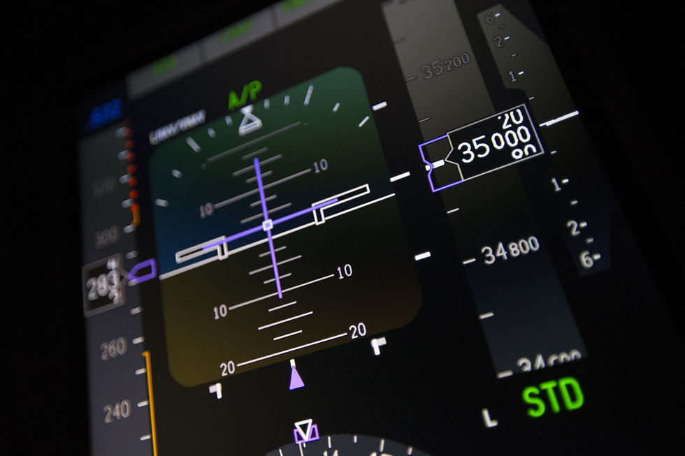
GLS aims to provide landing capability equivalent to the ILS CAT III systems. This would finally provide a cost-effective All-Weather Operation (AWO) landing system for demanding installation locations [2].
The GBAS concept
Global Navigation Satellite Systems (GNSS) have greatly improved the navigation capability of aircraft. Nevertheless, these systems in their basic form lack the accuracy and integrity levels required to support approach operations type B (DH below 250 ft) [3]. Therefore, so-called augmentation systems are in place to compensate these deficiencies. The Satellite Based Augmentation System (SBAS) provides this service for a large geographical region (e.g., WAAS in the US, EGNOS in Europe) and enables lower minima, known as Localizer Performance with Vertical guidance (LPV). For AWO, the requirements are even more stringent and a local augmentation of the GNSS signals is required [3]. This leads us to the fundamental GBAS concept.

A GBAS station is located at the landing site, consisting of typically four receivers and a control station. Based on the calculated position of the reference receivers, the control station sends correction and integrity data to the aircraft using a VHF data broadcast (VDB). The Final Approach Segment (FAS) parameters are also broadcast in this manner [4] [2]. This enables one GBAS station to serve multiple different approaches to different runways. A particular approach is identified using a GLS channel number. There are different levels of GBAS Approach Service Types, defined in the ICAO SARPS [5]:
GAST-C
The typical GLS approach minima in service today, providing CAT I minima. Examples are Bremen (EDDW), Frankfurt (EDDF), Zürich (LSZH) and Sydney (YSSY).
GAST-D
Has been introduced in ICAO Annex 10 in 2018 and stipulates the requirements for GLS CAT II/III minima. There is an experimental GAST-D installation in Frankfurt, serving the SESAR research program [11].
Additionally, other service types have been proposed under the European SESAR program in order to improve GLS capabilities [4]:
GAST-E
Potential fallback mode for CAT I operations using GPS L5 and GALILEO E5a signals.
GAST-F
Proposal for Dual-Frequency, Multi-Constellation (DFMC) GBAS significantly reducing Ionospheric disturbances, based on GPS L1/L5 and GALILEO E1/E5a. This has been experimentally tested in Toulouse (LFBO) and Braunschweig (EDVE) [11].
Challenges
Ionospheric gradient
The Ionosphere has been a challenge for many navigation and communication systems in the past. It remains a problem for GNSS. The Ionosphere creates disturbances in the signal propagation for GNSS, as it causes group delay and phase advance [6]. This has been known for years and there are generally three ways to overcome this problem [1] [6]:
Use a model to account for ionospheric effects
This is not very accurate and yields poor results. This is what single-frequency receivers generally do.
Use a reference-station on the ground to measure the local effect and forward this information to the airborne receiver.
This was the fundamental idea behind GBAS. As we will see, there are still some pitfalls.
Take advantage of the fact, that the ionospheric effects are frequency-dependent i.e., they can be eliminated mathematically if using a dual-frequency receiver.
This is by far the best method and has been used outside of civil aviation for years.
The current GBAS systems providing GAST-C and also the GAST-D SARPS are based on GPS L1 frequency, using C/A code only [4] [5]. This makes them vulnerable to ionospheric disturbances.

The idea of having a local reference station was, amongst others, to remove ionospheric delay errors. During the validation phase GLS, it was discovered, that the aircraft station might be subject to different ionospheric delays than the reference station, particularly for high- and low-latitude regions [3]. This is due to the fact, that the Ionosphere can develop large gradients in these areas. So, the ground station might not “see” the same ionospheric error than the airborne receiver. An un-corrected Ionospheric gradient error can lead to an 8.5 m position error at a CAT I minimum if that point is located 6 km from the ground station [3]. The mitigations under the current ICAO SARPS are the following [7]:
GAST-C stations perform a “geometry screening” and inflate the integrity parameters of the satellites that would very likely produce large ionospheric gradient errors. This can lead to availability problems.
GAST-D SARPS contain additional monitoring requirements for the airborne receiver and may impose additional siting requirements [5]. The monitoring procedures rely on statistical models and often create overconservative results, impairing the availability under certain conditions [8].
Caamano et al. [8] proposed a monitoring network of DFMC GNSS receivers in order to detect the actual ionospheric gradients and improve the availability of GAST-C/D. Their research demonstrated that ionospheric gradients can be detected in real-time, see below:

The solid lines depict the automatic detection of a strong ionospheric gradient.
VHF Data Broadcast (VDB)
The VDB has been criticized for being too limited in bandwidth, range and cyber security protections by several industry experts [9]. While the capability might be adequate for today’s single-frequency, single-constellation GBAS, it will very quickly reach the limit if the correction data should be provided for multiple constellations simultaneously [9]. Additionally, there are interference challenges with existing aeronautical systems in the VHF band, such as ILS and VOR [5].
Equipment requirements
The receivers for VDB are typically not available on commuter category and lighter aircraft. This essentially limits GLS to transport category aircraft.
Slow development
The GLS approaches available today, typically provide CAT I minima. In contrast to SBAS, the GBAS does require local installations at the landing site. If there is no operational benefit from GBAS over SBAS, such an installation is hard to justify.

Mitigations
DFMC GBAS
The use of Dual-Frequency, Multi-Constellation DFMC receivers is one of the most important next steps in civil aviation satellite navigation. It will significantly improve the resilience, integrity and availability of the navigation solution. Further, it will serve as a remedy for the ionospheric gradient problem [7].
GBAS via LDACS
The L-Band Digital Aeronautical Communication System (LDACS) is part of the Future Communication Infrastructure (FCI) and will serve as a medium-range communication system, with optional navigation application [10]. As such, it would be an ideal alternative to the VDB, as it uses state-of-the-art communication standards and can be deployed in-line with the current industry roadmap [10]. It can also overcome the capacity and cyber-security concerns of the current VDB [9].
Conclusion
GLS has great potential and the current implementation challenges can be overcome. It is important that the stakeholders undertake coordinated efforts to make this happen. At the moment, the industry seems stuck in a “chicken and egg” situation where airlines are reluctant to equip their fleet due to lack of benefits, and airports are hesitant to invest in infrastructure due to lack of users.
References
[1] I. Moir, A. Seabridge und M. Jukes, Civil Avionics Systems, Wiley, 2nd ed., 2013.
[2] Boeing, «Boeing GBAS and SBAS Overview,» ICAO GBAS SBAS workshop, 2019.
[3] ICAO, «GBAS safety assessment guidance,» 2016.
[4] M.-S. Circiu, «Integrity aspects for dual-frequency, dual constellation GBAS,» RWTH Aachen, 2020.
[5] ICAO, Annex 10, Aeronautical Telecommunications, vol. 1 Radio Navigation Aids, 7th ed., 2018.
[6] P. J. Teunissen und O. Montenbruck, Springer Handbook of Global Navigation Satellite Systems, Springer, 2017.
[7] S. Pullen et al., «Impact of Ionospheric Anomalies on GBAS,» 2017.
[8] M. Caamano et al., «Network-based ionospheric gradient monitoring to support GBAS,» Wiley, 2020.
[9] N. Mäurer, M. Caamano, D. Gerbeth, T. Gräupl und C. Schmitt, «A Secure Broadcast Service for LDACS with Application to Secure GBAS,» German Aerospace Center DLR, 2021.
[10] Eurocontrol, EU commission, «European ATM Master Plan,» 2020.
[11] Feuerle et al. «GBAS Interoperability Trials and Multi-Constellation/Multi-Frequency Ground Mockup Evaluation», presentation at SESAR Innovation days, 2016.